
Cartographers in Year 5
Year 5 have been learning the skills of cartography as they map different spaces around school.
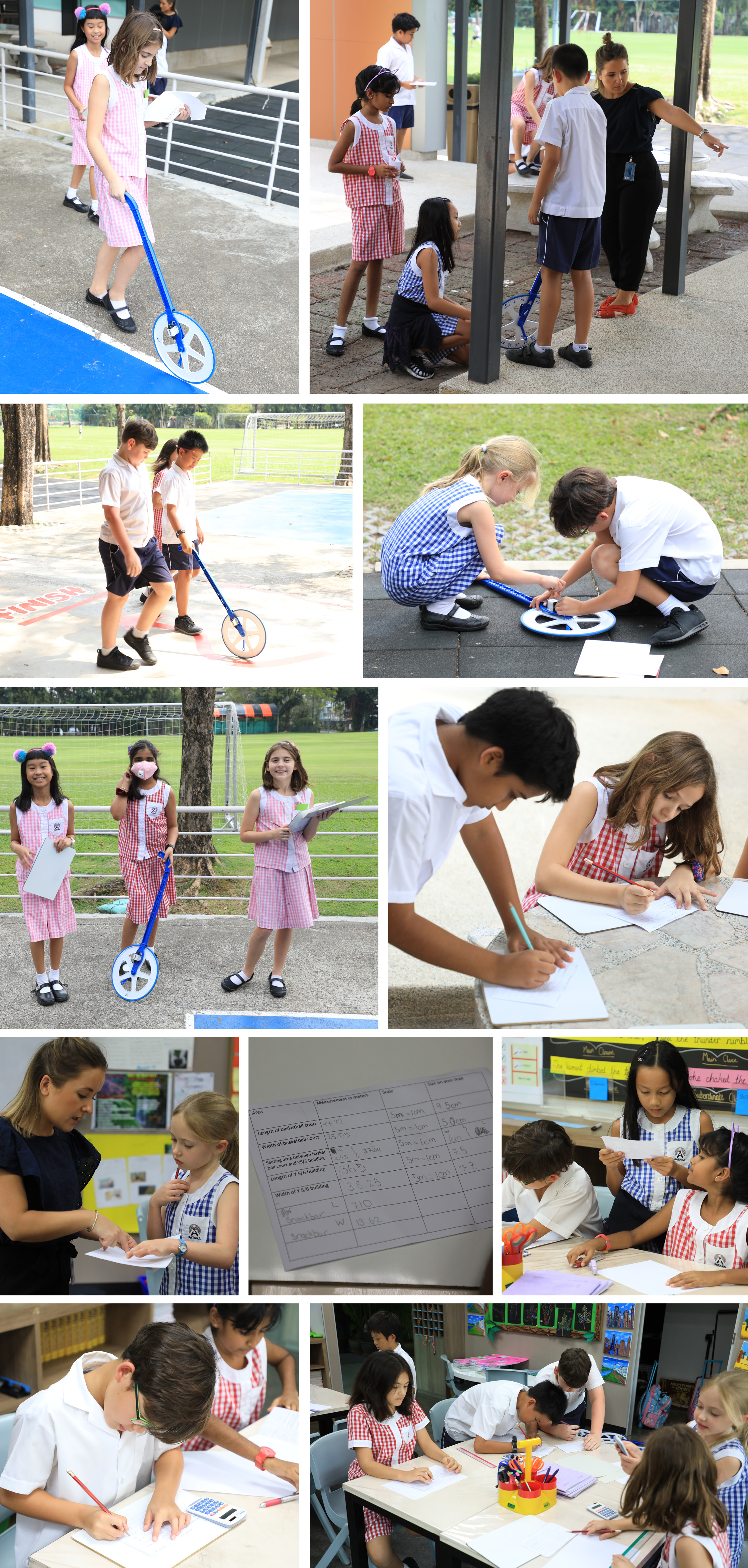
What is a scale and how do we use them? This week Year 5 students became cartographers and attempted to create maps of the spaces they use around school. Using measuring equipment, they headed out to measure the size of the buildings and playing spaces making sure they double checked each measurement to ensure accuracy. Next came the tricky part, drawing large spaces onto small sheets of paper. In pairs, they carefully considered how they could scale down the measurements to ensure their maps remained accurate.
The learning linked to their theme of ‘Rainforests’ as they have been studying maps and atlases to locate and estimate the size of rainforests across the planet.